Looking for some accessible walks for the weekend?
We’ve got five accessible walks just for you.
Getting out for a walk to breathe some fresh air is one of the best ways to get you in a good mood.
If you’re walking with a wheelchair or anything on wheels, the best thing to do is ensure the walk is suitable for your equipment.
There are plenty of websites where you can search for accessible routes and local councils can often provide information on the best accessible walks in their areas.
Luckily we’ve found five different walks that are suitable for a variety of different abilities. And they’re all wheelchair accessible!
So, whether you’re bringing a pushchair, a wheelchair, or a mobility scooter, and whether you want a short walk or a long walk, you shouldn’t have any problems going for a walk on these routes.

Budleigh Salterton walks from Lime Kiln car park: Under a mile (one way)
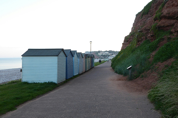
This is a short, easy walk starting from Lime Kiln car park in Budleigh Salterton. There are a selection of walks you can do around here, but we’d recommend going along the sea front and on to the town centre.
There’s a tarmac path which is perfect for any wheels. And there’s plenty of seats if you need to stop for a rest. Plus there’s also wheelchair accessible public toilets.
The town centre is filled with shops and cafes so it’s the perfect place to grab lunch or breakfast.
This walk is about a quarter of a mile each way and you can absolutely bring your furry friends.
Starting from the same car park, you could also walk alongside the banks of the Otter Estuary. It goes along a smooth and compacted stone path which has a few slopes here and there but is mostly flat.
You might spot a few birds and there’s even a wheelchair accessible viewing platform and bird hide beside the path. There’s also a few seats along here if you need a break.
You’ll eventually come to a kissing gate. Any wheelchairs would need a tight turning circle to get through here and the terrain going along the other side of the nature reserve is a lot bumpier. So, we’d recommend turning around and walking back to the car park at this point.
That walk is about half a mile each way.

Bolberry Down – Kingsbridge: 1 mile (circular walk)
This is one of the loveliest accessible walks on our list.
Bolberry Down is a splendid walk with an accessible surfaced path that’s full of wildflowers in summer and there’s pockets of gorse everywhere you look.
Beginning in the Bolberry Down National Trust car park, you’ll follow the trail along the edge of the road towards Oceans Reach. You’ll eventually come to a metal gate then bear left onto the tarmac path that heads towards the sea.
Continue along the trail until you have to bear right onto a gravel path. You’ll get to take in some of the most breathtaking views, both inland and out to sea.
Bolberry Down is a circular walk, however, if you’ve got a wheelchair with you, there’s a kissing gate set in a stone wall about half way, so you can turn around here and walk back to the car park. Or if you do go through the kissing gate, the return leg is on a well-used grass path.
This part of the South West Coast Path is relatively flat and the National Trust have actually undertaken some work to ensure that the path can be used by those with wheelchairs and buggies.
The whole walk is about a mile so it’s a nice choice if you’re after a more relaxing walk with nice views. You can also bring dogs, but they must be kept on their lead.

Exe Estuary Trail: Exmouth to Lympstone: 2 miles (one way)
Starting at Exmouth train station, this walk follows the Exe Estuary Trail where you’ll get to see stunning views of the estuary, lots of birds and other wildlife.
The trail stretches from Exmouth to Exeter Quay and on to Dawlish Warren, so it’s a pretty long walk if you do the whole thing. But Exmouth to Lympstone and back is approximately 4 miles, so you can either walk there and back or just catch a train back from Lympstone train station.
So starting from Exmouth train station, you’ll follow the trail which goes alongside the railway line. You should see signs but it’s by the far left-hand corner of the car park. Follow the path and signs until you arrive at Lympstone train station.
The Exe estuary is a traditional stop-off for migratory birds; this writer always sees lots of Canadian geese and you hear their wings flapping too. You might even get lucky and spot otters or seals!

Tarka Trail – Barnstaple to Fremington Quay: 2.7 miles (one way)
The Tarka Trail is an off-road route that stretches from Braunton to Meeth in North Devon.
It’s surfaced all throughout, but it’s important to note that there’s no wheelchair access at Landcross or Loxdown. There is parking available at several points along the trail which makes it perfect if you only want to do a certain part of the trail.
For an accessible walk, we’d recommend starting at Barnstaple where there’s an option of two car parks. The one at the train station offers direct access to the trail but the car park at Severn Brethren is a lot bigger if you struggle to find space and it’s also not as expensive.
Walk along the SW Coast Path and you’ll get gorgeous views of the Taw River, then you’ll end up at Fremington Quay where you can enjoy an ice cream at the café. And if you don’t fancy walking back to Barnstaple, you can just catch a bus back from Fremington.
This part of the trail is about 2.7 miles which will probably take around an hour and a half.

Revelstoke Drive and Noss Mayo: 4 miles (circular walk)
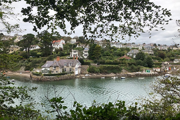
Noss Mayo is an ancient and secluded village, about six miles south-east of Plymouth, and is a lovely, picturesque place to visit if you want to get away from a busy lifestyle.
Beginning at the National Trust car park at Warren (PL8 1EL), take the track until you get to the coast path, then turn right. This’ll take you on to Revelstoke Drive where you can enjoy the views over Wembury Bay towards Plymouth Sound. You’ll then come towards a cottage with a couple of gates to walk through.
Keep following the path and you’ll pass Gara Point and Brakehill Plantation, and Passage Wood. If you have a wheelchair, make sure you continue along the drive and don’t take the left path as there are steps at the end (this runs parallel to the drive anyway). You’ll then end up at the old fishing village of Noss Mayo.
Stop off at The Ship Inn for a little break and snack before you make the trek back to your car. At the end of the road, you’ll see the village hall where you’ll want to continue up the hill on the left. The road will bend sharply round to the left, turn right and continue along the track until you get to the end. Then turn left and the National Trust car park will be 25m on your right.
This walk is a lot longer than others on our list, so make sure to bring plenty of water and food if you get a bit peckish on the journey. The circular walk is about 4 miles which is meant to take about two and a half hours, but if this is a bit too much, feel free to turn around at any point.
The sea views will still be absolutely stunning if you don’t quite make it to Noss Mayo. Or you could even do some of the walk in reverse instead!


